Tourism Association Gsiesertal Valley-Welsberg-Taisten in South Tyrol
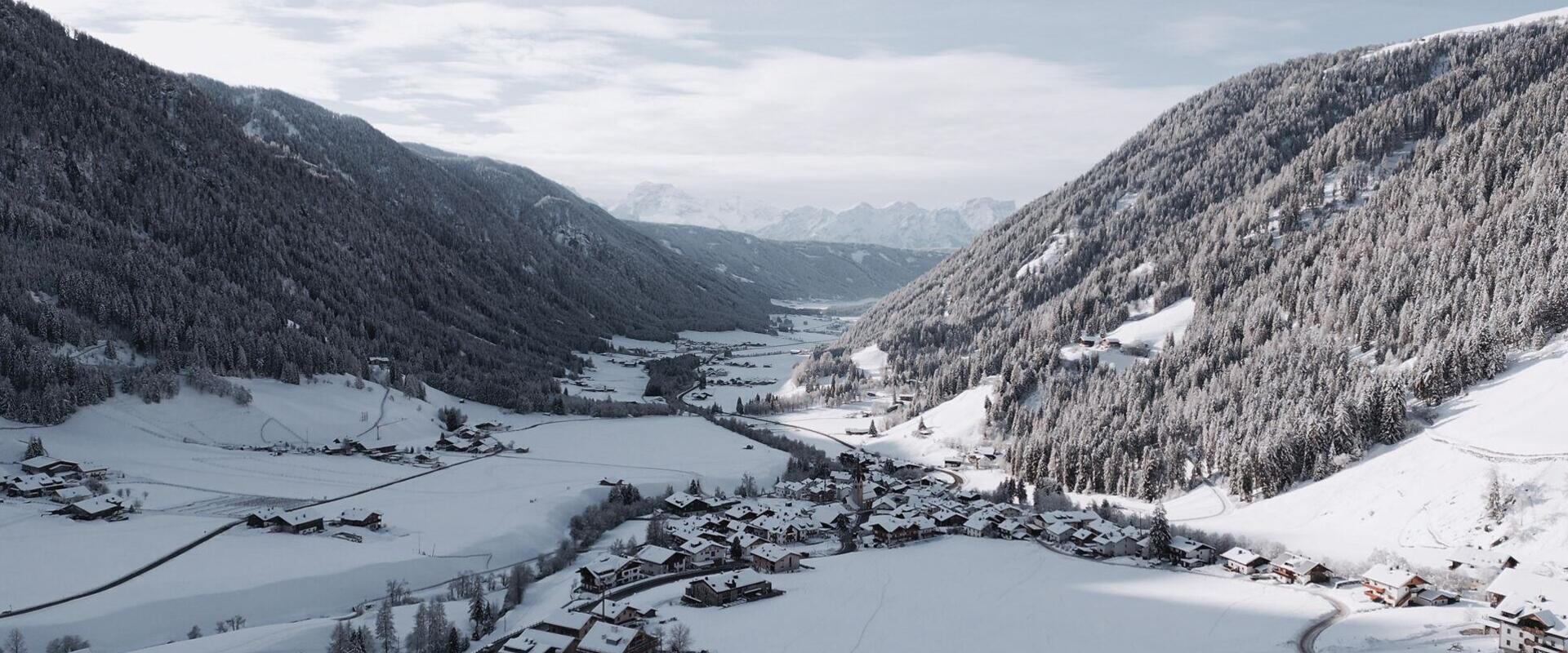
  • Aerial winter view of St. Magdalena and St. Martin in Gsiesertal Valley, looking towards the Dolomites
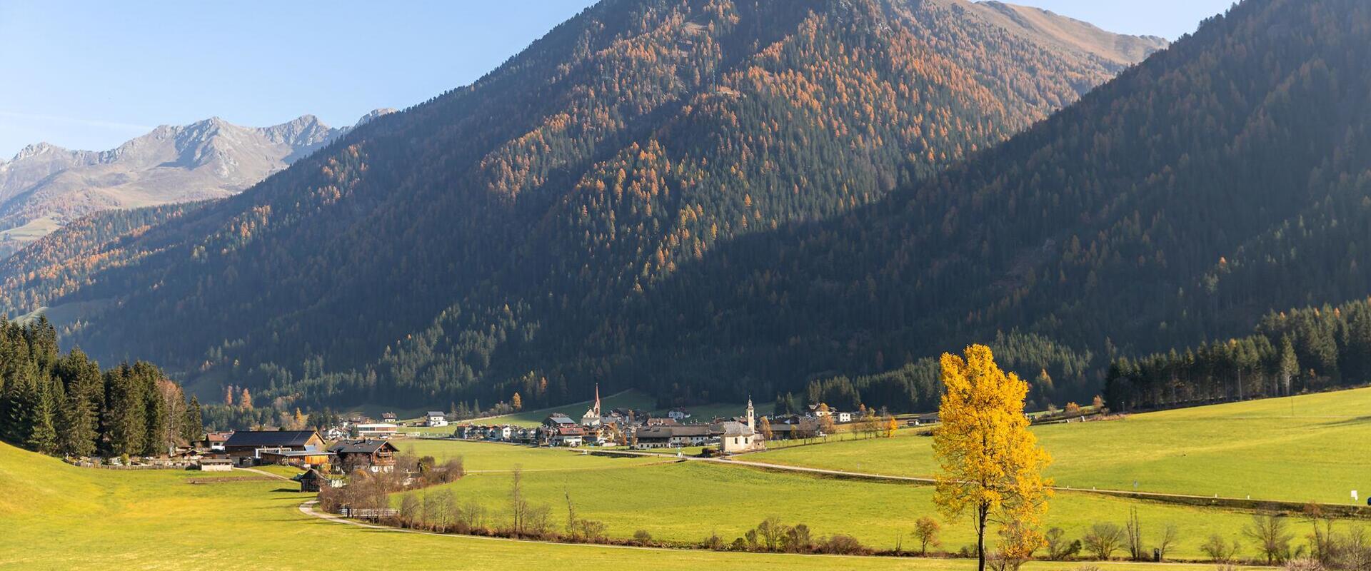
  • Autumn landscape in the Gsiesertal valley with St. Martin in the distance
Authentic. Peaceful. Close to nature.

Gsiesertal Valley in South Tyrol

A quiet side valley at the foot of the Dolomites.

Gsiesertal Valley stretches from Pichl through St. Martin to St. Magdalena, becoming increasingly alpine as you travel further into the valley. Open meadows, forests and traditional farmhouses shape the landscape, while the mountains draw ever closer towards the head of the valley.

Life here remains closely connected to farming. Trails lead from the villages up to working alpine huts or scenic mountain peaks, offering different ways to explore throughout the year. In summer, discover Gsiesertal Valley while hiking or cycling. In winter, follow the cross-country ski trail, explore the snowy landscape on snowshoe hikes or winter walks, or head into the mountains on a ski tour. The ski lifts in Pichl and St. Magdalena add to the winter activities available.

What makes Gsiesertal Valley special is not so much a single attraction, but the valley as a whole. Among long-established villages, working farms and wide-open spaces, its unspoilt character is still very much part of everyday life. And often, it is the quiet moments in between that stay with you.
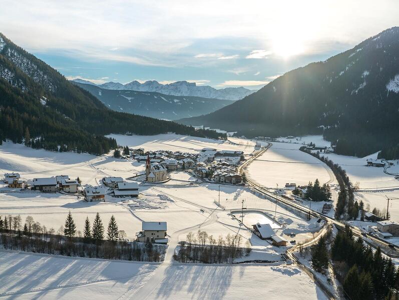
Aerial winter view of St. Martin in Gsiesertal Valley, with snowy scenery and the Dolomites in the distance
Gsiesertal Valley at a glance

Population
approx. 2,400
Altitude
approx. 1,190–1,500 m
Villages
Pichl · St. Martin · St. Magdalena


It happens almost without you noticing: you slow down, feel at ease and find yourself wishing you could stay a little longer.

Sights and local highlights in Gsiesertal Valley
Animal Park Reierhof
open Open
Animal Park Reierhof
info@reierhof.com
+39 388 1940304, 348 9529370
https://www.reierhof.com
Cheese dairy Waldsamerhof
closed Closed
Cheese dairy Waldsamerhof
info@waldsamerhof.it
+39 0474 948009
http://www.waldsamerhof.it
Parish Church of Saint Magdalene
open Open
Parish Church of Saint Magdalene
info@gsieser-tal.com
+39 0474 978436
Lahnhof farm
open Open
Lahnhof farm
info@lahnhof.eu
+39 348 3549791
https://www.lahnhof.eu/
Parish Church of Saint Nicholas
open Open
Parish Church of Saint Nicholas
info@gsieser-tal.com
+39 0474 978436
Klanschta BIO Fleisch /  BIO meat
open Open
Klanschta BIO Fleisch / BIO meat
huberalex87@yahoo.de
+39 340 2312659
Parish Church of Saint Martin
open Open
Parish Church of Saint Martin
info@gsieser-tal.com
+39 0474 978436
Recreational area Schneider Waldile
open Open
Recreational area "Schneider Waldile"
info@gsieser-tal.com
+39 0474 978436
http://www.gsieser-tal.com
Turner Josef Taschler
closed Closed
Turner Josef Taschler
info@rotmoos.com
+39 0474 948083
https://www.rotmoos.com
Farm Shop Regiohof
closed Closed
Farm Shop Regiohof
info@regiohof.com
+39 0474 948562
https://www.regiohof.com/
Hintnerhof farm
open Open
Hintnerhof farm
info@hintnerhof.com
+39 347 5374471
http://www.hintnerhof.com
Lahnhof farm
open Open
Lahnhof farm
info@lahnhof.eu
+39 348 3549791
https://www.lahnhof.eu/
Riding stable Sun Ranch Sonnenhof
closed Closed
Riding stable "Sun Ranch" Sonnenhof
info@reiten-sonnenhof.it
+39 377 0919557
https://www.reiten-sonnenhof.it
Outdoor activities in Gsiesertal Valley
Discover what you can do outdoors. Find something that feels just right for you.
36 Results
open
open
filter Filters
9
36 Results
Gsieser Almweg 2000
open Open
distance 26.6 km
divider
time 8:40 h
divider
elevation 1619 hm
Medium
The Almweg 2000 trail in the Gsiesertal Valley
starting-point
Starting point: Gsiesertal – St. Martin
ending-point
Arrival point: Gsiesertal –St. Magdalena, Head of the valley
Hochkreuz
open Open
distance 17.5 km
divider
time 6:2 h
divider
elevation 1337 hm
Hard
Circular hiking trail along the borders in the Gsiesertal Valley
starting-point
Starting point: Gsiesertal Valley – St. Magdalena, Head of the Valley
ending-point
Arrival point: Gsiesertal Valley – St. Magdalena, Head of the Valley
Mountain hike Hörneckele
open Open
distance 17.3 km
divider
time 5:32 h
divider
elevation 976 hm
Medium
Gsiesertal Valley Almweg 2000 path: Stage Hörneckele, Pfinnalm, Ascht Alm
starting-point
Starting point: Gsiesertal – St. Martin
ending-point
Arrival point: Gsiesertal – St. Magdalena
Gsieser Törl
open Open
distance 16.2 km
divider
time 5:16 h
divider
elevation 989 hm
Medium
Gsiesertal Valley Almweg 2000 path: Stage to the Gsieser Törl (2205 m)
starting-point
Starting point: Gsiesertal Valley – St. Magdalena, Head of the valley
ending-point
Arrival point: Gsiesertal Valley – St. Magdalena, Head of the valley
Mountain hike Schwarzsee
open Open
distance 17.1 km
divider
time 6:2 h
divider
elevation 1424 hm
Hard
Mountain hike: To the lake Schwarzsee and mountain Hochkreuzspitze (2455 m/2739 m)
starting-point
Starting point: Gsiesertal Valley – St. Magdalena, Head of the Valley
ending-point
Arrival point: Gsiesertal Valley – St. Magdalena, Head of the Valley
Mountain hike Toblacher Pfannhorn
open Open
distance 24.5 km
divider
time 8:13 h
divider
elevation 1682 hm
Hard
Mountain hike: Bonner Höhenweg and Toblacher Pfannhorn (2663 m)
starting-point
Starting point: Gsiesertal Valley – St. Magdalena, Head of the valley
ending-point
Arrival point: Gsiesertal Valley – St. Magdalena, Head of the valley
Mountain hike Gsieser Toerl
open Open
distance 17.9 km
divider
time 5:44 h
divider
elevation 1010 hm
Medium
Mountain hike: Gsieser Törl in the Gsiesertal Valley (2205 m)
starting-point
Starting point: Gsiesertal Valley – St. Magdalena, Head of the valley
ending-point
Arrival point: Gsiesertal Valley – St. Magdalena, Head of the valley
Direction Hinterbergkofel
open Open
distance 22.4 km
divider
time 7:57 h
divider
elevation 1892 hm
Hard
Mountain hike: Alpini Steig trail in the Gsiesertal Valley
starting-point
Starting point: Gsiesertal Valley – St. Magdalena, Head of the valley
ending-point
Arrival point: Gsiesertal Valley – St. Magdalena, Head of the valley
Hiking
open Open
distance 23.1 km
divider
time 7:17 h
divider
elevation 1214 hm
Hard
Mountain hike: The lakes Ochsenfelder Seen in the Gsiesertal Valley (2555 m)
starting-point
Starting point: Gsiesertal Valley – St. Martin, Village Centre
ending-point
Arrival point: Gsiesertal Valley – St. Martin, Village Centre
« ‹ 1 2 3 4 › » 36 items on 4 pages, displayed items 19-27
Food and experiences in Gsiesertal Valley
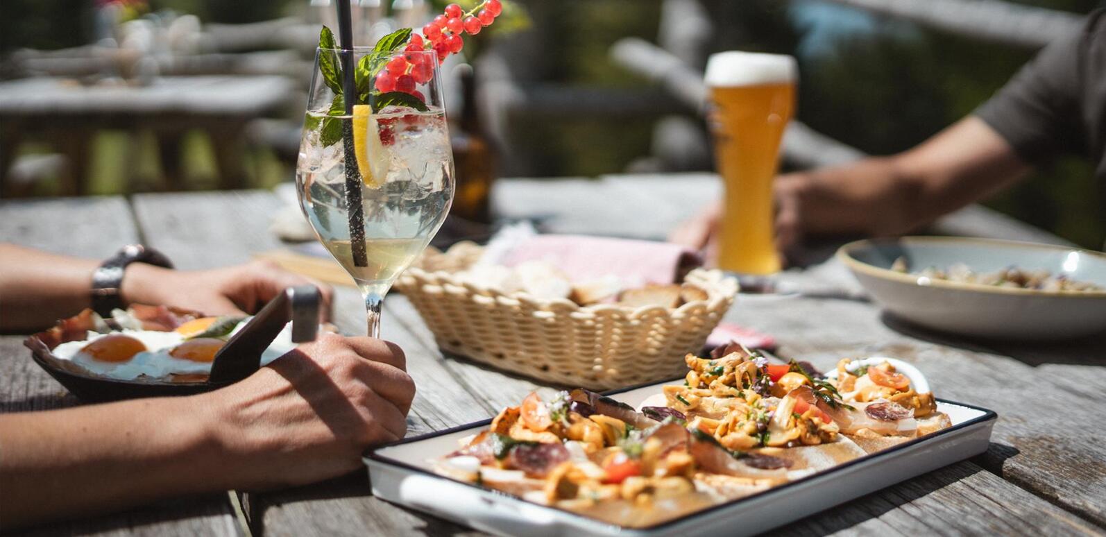
Guests enjoying food and drinks at a wooden table during a summer stop at an alpine hut
Food & drink
From village inns to mountain huts serving food, regional cuisine and a chance to stop for a meal are part of exploring Gsiesertal Valley. Discover the valley's restaurants, inns, alpine huts and mountain refuges.
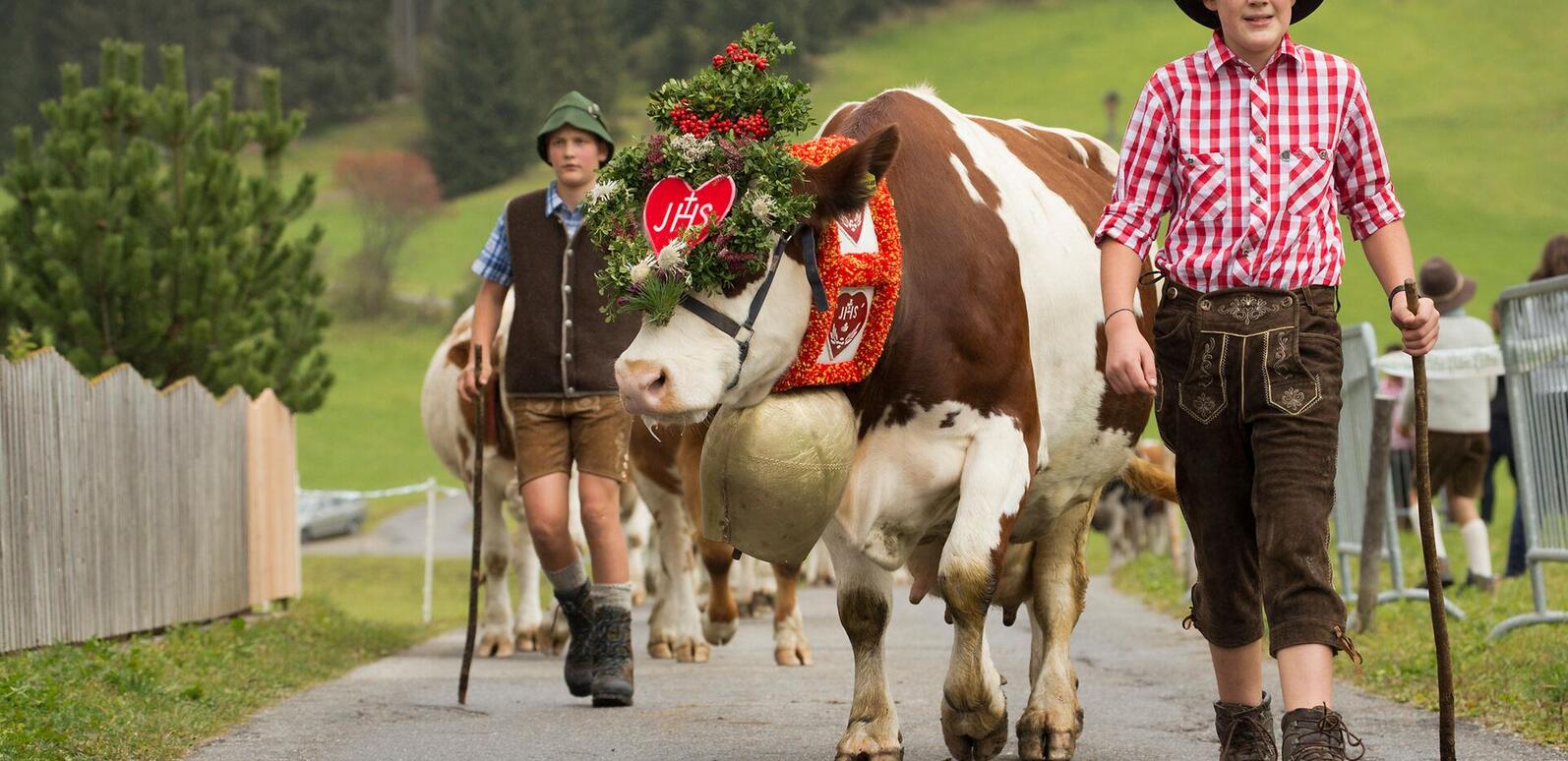
Young men in traditional dress accompany a decorated cow during the cattle drive in St. Magdalena
What's on
From traditional festivals and village celebrations to sporting and food events, many occasions grow out of everyday village life. Discover what's happening in Gsiesertal Valley and join the celebrations, gatherings and local events.
Explore the neighbouring villages
Discover more of the region
From Gsiesertal Valley, Taisten and Welsberg are just a short distance away – two villages, each with a character of its own.
heart decoration